# Measurement tool
Important aspect of validating and reviewing designs is measurement. Site Management offers three different types of measurements, each with specific purpose. The measurement tool automically changes the units to more appropriate, from millimeters to centimeters, meters and eventually to kilometers.
The Q1/2024 release introduced the possibility to have multiple measurements visible at the same time.
Measurement tool can be found in the Tool -menu (the one with hammer -icon).
### Distance measurement
**Distance measurement** simply calculates distance between two or more points. The tool shows two different values, total distance and distance from previous point.
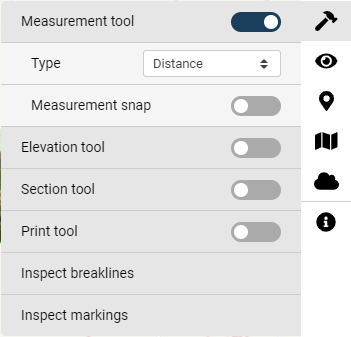
Distance -option in Measument tool
Activating the measurement tool, click on the "**Measurement tool**" slider and select the wanted type. Measurement snap -option allows the tool to be snapped on LandXML elements.
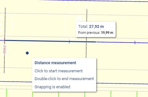
To measure, click on location where the measurement starts and click on the next location. Double-click while using the tool will end the current measurement, but the tool stays active. The picture below shows distance measurement -tool tip and the actual measurements.
Distance measurement -tool tips
### **Area measurement**
**Area measurement,** like the name suggests, is meant for areal measurement. The same exact workflow applies to area measurement.
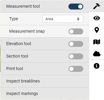
Area -option in Measurement tool
Select the Area -option from Type -dropdown menu to start the tool. Click the starting location on the map and click one or more other locations to complete the measurement. Double-clicking on a location will end the measurement and display the results.
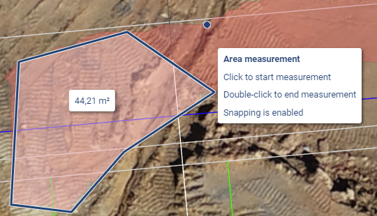
Area measurement and tool tip
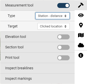
### **Station - distance measurement**
Station - distance measurement varies from the previous two options. There is a prerequisite that a LandXML alignment must be visible on the map. Tool allows to check distance from an alignment to a specified location. This specified location can be either clicked from the map or when using a mobile device, user's location can be used as one.
Station - distance -option in Measurement tool
{% hint style="info" %}
Notice that when Station - distance -type is selected, that there are two different options for target.
{% endhint %}
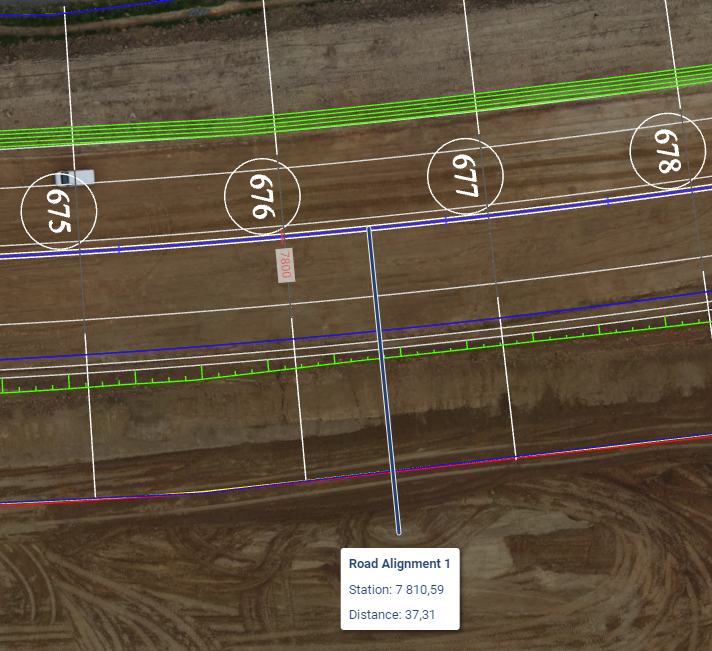
Like the tooltip suggests start the measurement by picking an alignment from the map. Once the wanted alignment is selected, click on the location which information is needed.
Station - distance -tool results
Once a location is clicked, Site Management calculates the distance to that specific point perpendiculary from the alignment. As a result the tooltip will present the name of the alignment, station that the wanted location is on and distance from the alignment to that point.
{% hint style="info" %}
When on a site, use the Geolocation -tool and station - distance -tool to get into the detailed information about the location and distances.
{% endhint %}