Be.Smart Site Management
  • ℹ️What is Be.Smart Site Management?
  • βš™οΈRequirements
  • πŸ’ΎSupported file formats
  • πŸ†•What's new ?
    • Q1/2023 Release
    • Q2/2023 Release
    • Q3/2023 Release
    • Q1/2024 Release
  • Getting started
    • Project set up in Trimble Connect
      • Create a project to Trimble Connect
        • Create a blank project (Trimble Connect)
        • Create a project based on template
      • User management in Trimble Connect environment
      • Project settings in Trimble Connect
    • Project set up in Autodesk Construction Cloud
      • Create a project to ACC
        • Create a blank project (ACC)
      • User management in ACC environment
    • Project set up in Site Management
      • Site Management - Project configuration
        • Coordinate reference system
        • Project location
        • Toggles
        • Coordinate formatting
        • AIS marine traffic
        • Application background maps
        • Background maps
        • Overlay maps
        • Default background map
        • Default models
        • Project links
        • Connections
        • Permissions and Metadata
      • Settings for Site Management
  • Site Management
    • Project interface
      • Toolbar
      • Project tree
      • Map interface
    • πŸ“Measurement tool
    • πŸ“ˆElevation tool
    • βœ‚οΈSection tool
      • How to create a section
      • Measurements in sections
      • Breaklines in section
      • Print tool in a section
    • πŸ–¨οΈPrint tool
      • Print tool options
    • πŸ“Inspect breaklines
    • ✏️Markings
      • Creating a marking
      • Editing a marking
      • Inspect markings
      • Filtering markings
      • Use-cases for markings
    • πŸ“ΈPresets
      • Creating a preset
      • Open a preset
    • πŸ—ΊοΈMap layers
    • πŸŽ₯3D viewers
  • Integrations and extensions
    • GeoView -integration
    • Pointscene -integration
      • Define the calculation type
      • Select the point cloud
      • Select the LandXML -file
      • Defining the boundary
      • Visualization
      • Results
    • Utilization -extension
      • Utilization report
    • Machine Control -extension
      • Novatron/MOBA Xsite Manage
      • Topcon Sitelink 3D v2
Powered by GitBook
On this page
  • Displaying models
  • Functionalities
  1. Site Management
  2. Project interface

Map interface

Map is the centerpiece of Site Management

PreviousProject treeNextMeasurement tool

Displaying models

Controls

Moving on the interface is done by using mouse. Holding down left mouse button it is possible to move around the map by dragging. Single click of left mouse button is used to select objects.

Mouse wheel is used for zooming in and out.

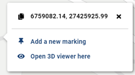
Clicking right mouse button has two functions: create a marking or open the 3d viewer.

Models

Models are opened to the map interface by checking the box next to the wanted files. The project must have a coordinate reference system assigned to it from Project Configuration to be able to display files.

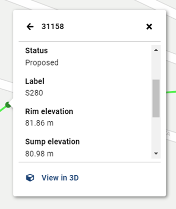
Once models are opened, user can view them and check the metadata within object.

By right clicking the map interface user can open the visible models directly to 3d Viewer.

Possible errors

Supported file formats sometimes contain data which cannot be displayed on map. User is informed with an exclamation mark in front of the model.

User might face unlikely errors when opening files, usually this due to the LandXML being against the schema.

Currently there is a file size limit of 100 mb, if the file exceeds that, it won’t processed nor displayed. Please contact your local Site Management supplier if you are facing issues with the file size limit.

Functionalities

There are some functionalities hidden in the map, which can be used by clicking diffent types of objects.

Hide models

Clicking an element on the map opens a dialog. In the dialog Hide models -functionalities removes the selected model in the active map view. Making it easy to hide models from the map, instead of searching these from the folder structure.

Alignment tools

If there is a LandXML alignment visible on the map, clicking it gives multiple options:

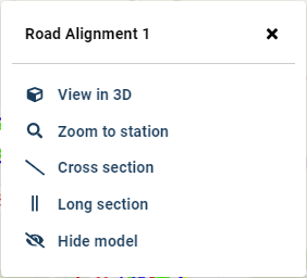
  • Zoom to station enables to search the wanted station on the alignment and automatically zoom to it.

  • Cross section and Long section make it faster to create a section based on this alignment

Right-click options
Error message - more information by hovering on top of the exclamation mark