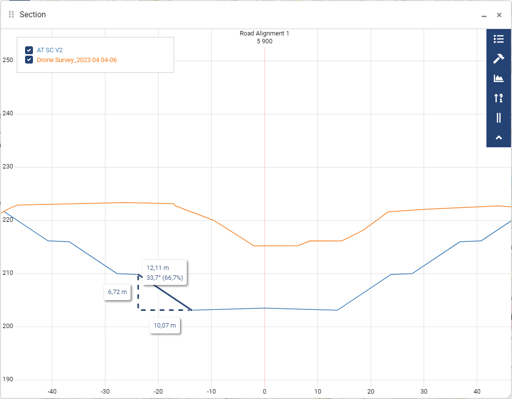
Measurements in sections
Viewing sections is one aspect, but as crucial is to make measurements in the visible section. There are total of four differen measurement types in the section tool:
Distance for simple measurements between two or more points
Area to measure the areas from sections, which could be used for volume calculation
Slope to measure distance between two points, results are shown for X- , Y-, XY -distance and the value of the slope in angle and percentage.
Coordinate allows to query exact elevations from the model, results are shown in X and Y. X is the distance from the centerline and Y is the elevation.
The Q1/2024 release introduced the possibility to have multiple measurements visible at the same time.
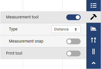
Start the measuring tool and select the wanted type of measurement. There is also a possibility use Measurement snap. This functionality snaps to the LandXML file objects for accurate measuring.